Ecology Risks
How to use Mycelia’s Ecology Risks tool.
On this page
Overview
Mycelia’s Ecology Risks tool checks uploaded Biodiversity Metrics for common risk factors that are not Metric errors but ecology concerns.
This is a significant step forward in how software can help in assessing ecological data. We’re very grateful to Greater Cambridge Shared Planning and MHCLG, who supported this development through the PropTech Innovation Programme.
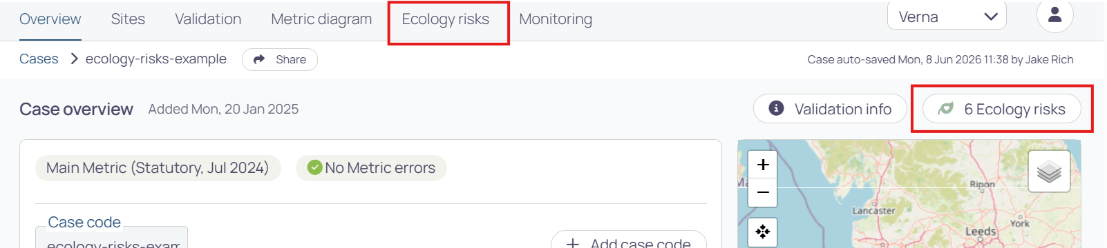
When you upload a Metric, you can find the Ecology Risks page from the Ecology Risks button above the map on the Case Overview page, or from the Ecology Risks tab in the top navigation menu:
The risk factors are based on input from many local government ecologists across the country, who have told us about the issues they most commonly see when checking through Metric data.
The aims of this feature are to:
- Help ecologists to spot these risk factors without having to comb through the Metric data manually.
- Help others in LPA teams to get a sense of whether there are risks present which might need attention from an ecologist.
This doesn’t replace the need for expert ecological assessment – computers can’t replace ecologists. But it saves everyone lots of time, flags risks that are otherwise hard to spot, and targets ecologists’ attention to where it might most be needed.
Current ecology risk checks
Below are the Ecology Risk checks currently available in Mycelia. These are being adjusted and added to over time based on your feedback (please email mycelia-support@verna.earth with any thoughts).
Baseline
Risks associated with the assessment of baseline habitats.
High proportion of baseline area habitats in poor condition
This flags when more than 75% of the total area of medium or higher distinctiveness baseline habitats has been recorded as being in poor condition. That can be an accurate picture of the site, but a very high proportion of poor-condition habitat is worth a second look: it can sometimes point to limited survey effort, or to condition being understated to lower the baseline value and so inflate the apparent gain.
High proportion of baseline hedgerows in poor condition
This flags when more than 75% of the total length of medium or higher distinctiveness hedgerows or lines of trees has been recorded as being in poor condition. It may genuinely reflect the state of the hedgerows, but such a high proportion is worth checking, as condition is sometimes understated to reduce the baseline value and inflate the apparent gain.
High proportion of baseline watercourses in poor morphological condition
This flags when more than 75% of the total length of baseline watercourses has been recorded as being in poor morphological condition. It may be an accurate assessment, but a figure this high is worth checking, as poor condition can be used to lower the baseline value and inflate the apparent gain.
Potential for unrecorded open mosaic habitat
This flags small parcels (under 0.25 ha) of urban baseline habitat, which can sometimes indicate open mosaic habitat on previously developed land. Open mosaic habitat is high distinctiveness and valuable for invertebrates, so if it is present but not recorded, the baseline value could be underestimated and BNG requirements set too low. It is worth checking whether these parcels meet the definition.
Potential for unrecorded irreplaceable habitat
Some classifications can contain, or be confused with, irreplaceable habitats such as ancient woodland, ancient and veteran trees, or certain saltmarsh and scrub types. This flags baseline habitats with that potential. Irreplaceable habitat sits outside the BNG calculation, and where it would be affected a bespoke mitigation plan must be agreed with the LPA before permission is granted, so confirming whether any is present matters.
Potential for unrecorded habitats of higher distinctiveness
Some lower distinctiveness habitats look similar to more valuable ones and can be recorded in their place – for example croplands that might have field margins, bracken that might actually be grassland, or grasslands that might be lowland meadow. If a higher distinctiveness habitat has been recorded as something more common, the baseline value would be understated and the BNG requirement weaker than it should be.
Non-ecologist has completed small sites metric
The Small Sites Metric records who completed the site walkover. This flags when that person does not appear to be an ecologist or botanist. Habitat identification is skilled work, so there is a greater risk of misclassification. LPAs often ask the applicant for a short statement on how the surveyor gained their experience, and it is especially worth reviewing Mycelia’s AI photo checking results in these cases.
Site survey/walkover out of date
Habitat surveys have a shelf life. This flags when the site walkover date (Small Sites Metric) or metric completion date (Statutory Biodiversity Metric) is more than 12 months before the case was created in Mycelia. Best practice indicates that older surveys may no longer reflect the site, so they should be repeated, or the ecologist should provide a letter explaining why the original survey remains appropriate.
Walkover and baseline habitat photo date mismatch
Habitat photos in the Small Sites Metric should be taken at the time of the walkover, so they reflect the habitats as assessed. This flags when a photo’s date – entered manually or read from its metadata – does not match the recorded walkover date.
Incorrect strategic significance for baselines if an LNRS has been adopted
Where a Local Nature Recovery Strategy (LNRS) has been adopted, government guidance requires the strategic significance of all baseline habitats, on-site and off-site, to be set to ‘low’. This flags when a baseline habitat is recorded as anything other than low, as a prompt to check whether an LNRS is in place for the location.
Interventions
Risks associated with the proposed interventions, e.g. creations and enhancements.
Creation or enhancement of traditional orchard
Traditional orchard is a high distinctiveness habitat, and creating or enhancing it is not as simple as planting young fruit trees. It can take more than 30 years to establish and needs specialist establishment and management set out in the Habitat Management and Monitoring Plan (HMMP). This flags when traditional orchard creation or enhancement is proposed.
Development footprint may be missing
Most developments leave some urban habitat behind – buildings, hardstanding and the like. This flags when there are no urban habitats in the post-development picture, which can be a sign that the development footprint has been left out of the metric by mistake.
Interventions targeting good condition with high or very high difficulty
The metric assigns a technical difficulty to each creation or enhancement. This flags interventions that aim to reach good condition while also carrying a ‘high’ or ‘very high’ difficulty rating. These are ambitious commitments, and the HMMP should set out how the challenges will be met.
Wetland proposed when there is no wetland in the baseline
Wet habitats depend on the right hydrology being present. This flags when wetland creation or enhancement is proposed but there is no wetland in the baseline, which raises the question of whether the necessary water regime exists. The HMMP should explain how the wet conditions will be achieved.
Creation of vertical habitats
This flags when vertical habitats – ground-based or façade-bound green walls – are proposed. These are difficult to establish and maintain over the long term, so the HMMP should set out how they will be looked after.
Broad habitat and habitat type do not match
In the metric, each habitat type sits within a broader habitat category. This flags when a recorded habitat type does not belong to its selected broad habitat – usually because the broad habitat was changed after the habitat type was chosen, leaving the two out of step. It is a quick data-quality fix, but worth correcting because a mismatched pairing leaves it unclear which habitat was actually intended.
Off-site interventions with no referenced baseline
Off-site habitat works need to be traceable back to a baseline. This flags when an off-site creation or enhancement has no matching record (sharing the same off-site reference) in the Off-Site Habitat Baseline tab. Without that reference the off-site habitats cannot be properly tracked or audited, so it is worth checking the off-site baseline has been completed.
Proposed new post-development habitat in good condition
Creating a brand new habitat that is already in good condition is harder than it sounds – good condition is much more readily achieved by retaining habitats already in good condition, or enhancing those in poorer condition. This flags when a newly created habitat is recorded as reaching good condition, as a prompt to check the HMMP sets out a realistic path to get there.
On-site habitats targeting good condition
Habitats kept or created on-site after development are exposed to people and domestic animals, which makes good condition harder to achieve and sustain. This flags on-site habitats whose target condition is ‘good’, so you can check the HMMP explains how that will be reached and maintained despite those pressures.
Incorrect strategic significance for post-development if an LNRS has been adopted
Where an LNRS has been adopted, the ‘medium’ strategic significance setting should not be used – it only applies where no LNRS is in place. This flags when a post-development (non-baseline) habitat, on-site or off-site, has its strategic significance set to medium.
Post-development habitat highly vulnerable to climate change
This flags when a habitat that is highly vulnerable to projected UK climate change is created or enhanced post-development. These include water-dependent habitats such as blanket bog, fens, reedbeds and wet woodland; coastal habitats facing sea level rise and erosion, such as saltmarsh and coastal sand dunes; and drought-sensitive woodlands such as lowland beech and yew woodland. Over the 30-year monitoring period, shifts in temperature, rainfall, water tables or sea level may mean the habitat cannot be established or sustained in its current form. The HMMP should assess the habitat’s climate resilience and set out contingency measures if target condition cannot be maintained.
Post-development habitat moderately vulnerable to climate change
This flags when a habitat with moderate climate vulnerability is created or enhanced post-development – for example lowland heathland, lowland meadows, lowland calcareous grassland or traditional orchards, where management is the main driver of condition. The habitat is not at risk of being lost, but reaching and maintaining target condition may become harder as climate conditions shift over the 30-year monitoring period. The HMMP should set out how management prescriptions will account for this.
Losses
Risks associated with loss of important or irreplaceable habitats.
Metric indicates necessary bespoke compensation has been agreed
Losses of very high distinctiveness or irreplaceable habitat are only allowed where bespoke compensation has been agreed with the LPA and Natural England. This flags when the metric indicates such losses are proposed and that the necessary compensation has already been agreed. It is worth verifying this is the case and that a record of the agreement has been uploaded to Mycelia.
Metric indicates necessary bespoke compensation has not been agreed
Losses of very high distinctiveness or irreplaceable habitat can only proceed where bespoke compensation has been agreed with the LPA and Natural England. This flags when the metric indicates such losses are proposed but that the necessary compensation has not yet been agreed, so it is a prompt to resolve the compensation before the proposal can be accepted.
Permanent loss of natural watercourse
This flags proposed permanent losses of the ‘other rivers and streams’ watercourse habitat. The Main Metric User Guide is clear that this is not permitted – this habitat type must not permanently lose length – so any such loss needs to be revisited.
Size, length, trees
Risks associated with area, length, or numbers of trees.
Individual trees without supporting comments
Individual trees are recorded as an area habitat covering the space the trees occupy, generated by the main metric’s tree calculator. Because that calculator’s workings are not retained, the Main Metric User Guide asks applicants to note the number of trees in the User Comments. This flags individual trees habitats where those comments have been left blank.
Habitats with zero size
This flags habitats recorded with an area or length of zero. That can happen because of rounding in the metric spreadsheet, or a data entry slip, so it is worth checking these entries are correct.
Missing habitat reference numbers
The Habitat Reference Number lets an applicant label a habitat in the metric so it can be matched to their mapping. It is optional but very useful for cross-checking, and it is not the same as the ‘Ref’ column or the Off-Site Reference, which do different jobs. This flags habitats that do not have one.
New medium or larger trees proposed post development
Trees are normally planted as small specimens and grow over many years. This flags when new medium, large or very large trees (by trunk diameter) are proposed post-development, which is an unusual and expensive approach. The HMMP should explain how larger specimens would be planted, accessed and maintained – or, if small trees are being planted with a larger target size, how that size is realistic for the species within the 30-year period.
Very small habitat area or length
BNG habitat mapping normally uses a minimum mappable unit of 5m by 5m (0.0025 ha). This flags very small parcels – an area habitat under 25m², a hedgerow or watercourse under 20m, or a pond under 25m². Parcels this small are usually only appropriate where a habitat has been subdivided to show different conditions within the same type; otherwise they would normally be absorbed into the larger neighbouring habitat.